
FCCInfo.com
A Service of Cavell, Mertz & Associates, Inc.
(855) FCC-INFO
|
|
W26EM-D from 02/22/2011 |
|
|
||||||||||||||||
|
|
Status: License Application Accepted: 01/10/2022 License Expires: 04/01/2021 File Number: -0000179565 FCC Website Links: LMS Facility Details This Application Other W26EM-D Applications Including Superseded Applications Mailing Address Correspondence for W26EM-D Correspondence related to application -0000179565 Service Contour - Open Street Map or USGS Map (51 dBu) Service Contour - KML / Google Earth (51 dBu) Rabbit Ears Info Search for W26EM-D Site Location: 33-59-53.9 N 83-25-59.2 W (NAD 83) Site Location: 33-59-53.5 N 83-25-59.6 W (Converted to NAD 27) ERP: 0.1 kW Polarization: Horizontally polarized R/C AGL: 6 m (20 ft.) R/C AMSL: 234.3 m (769 ft.) Emission Mask: Simple Site Elevation: 228.3 m. (749 ft.) Height Overall*: 76.2 m (250 ft.) (* As Filed In This Application, may differ from ASR Data, Below.) Directional Antenna - Antenna Make/Model: Scala CL-1469 Antenna ID: 20778 Polarization: Horizontally polarized | ||||||||||||||||||
| Antenna Data for Antenna Id: 20778 W26EM-D LD File: -0000179565 Scala - CL-1469 Service: LD Standard Pattern: Y Pattern and Field Values Include a 160° Clockwise Rotation | 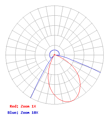 | ||||||||||||||||||
| Azimuth | Ratio | Azimuth | Ratio | Azimuth | Ratio | Azimuth | Ratio | ||||||||||||
| 0 | 0.010 | 10 | 0.010 | 20 | 0.010 | 30 | 0.010 | ||||||||||||
| 40 | 0.010 | 50 | 0.010 | 60 | 0.010 | 70 | 0.010 | ||||||||||||
| 80 | 0.010 | 90 | 0.010 | 100 | 0.010 | 110 | 0.086 | ||||||||||||
| 120 | 0.361 | 130 | 0.622 | 140 | 0.812 | 150 | 0.947 | ||||||||||||
| 160 | 1.000 | 170 | 0.947 | 180 | 0.812 | 190 | 0.622 | ||||||||||||
| 200 | 0.361 | 210 | 0.086 | 220 | 0.010 | 230 | 0.010 | ||||||||||||
| 240 | 0.010 | 250 | 0.010 | 260 | 0.010 | 270 | 0.010 | ||||||||||||
| 280 | 0.010 | 290 | 0.010 | 300 | 0.010 | 310 | 0.010 | ||||||||||||
| 320 | 0.010 | 330 | 0.010 | 340 | 0.010 | 350 | 0.010 | ||||||||||||
Structure Registration Number 1048022 Structure Type: GTOWER Registered To: American Towers LLC Structure Address: Twr 3 - 395 Jefferson River Road (#210202) Athens, GA County Name: Clarke County ASR Issued: 10/05/2021 Date Built: 01/01/1986 Site Elevation: 228.3 m (749 ft.) Structure Height: 76.2 m (250 ft.) Height Overall: 76.2 m (250 ft.) Overall Height AMSL: 304.5 m (999 ft.) FAA Determination: 09/21/2021 FAA Study #: 2021-ASO-17856-OE Paint & Light FAA Chapters: NONE 33-59-53.9 N 83-25-59.2 W (NAD 83) 33-59-53.5 N 83-25-59.6 W (Converted to NAD 27) |
1498 Buford Hwy Ste C 275 Sugar Hill, GA 30518 Phone: 770-771-1644 Applicant | Title: President Date: 01/10/2022 Application Certifier DTV INNOVATORS, LLC Dtv Innovators, Llc 7742 Spalding Dr Ste 475 Norcross, GA 30092 Applicant Susan Hansen B. W. St. Clair 2305 Vida Shaw New Iberia, LA 70563 | |||||||||||||||||