
FCCInfo.com
A Service of Cavell, Mertz & Associates, Inc.
(855) FCC-INFO
|
|
WWWN-LD from 01/12/2007 |
|
|
||||||||||||||||
|
|
Status: STA – Special Temporary Authority Application Accepted: 03/30/2022 STA Expires: 10/01/2022 File Number: -0000187722 FCC Website Links: LMS Facility Details This Application Other WWWN-LD Applications Including Superseded Applications Mailing Address Correspondence for WWWN-LD Correspondence related to application -0000187722 Service Contour - Open Street Map or USGS Map (51 dBu) Service Contour - KML / Google Earth (51 dBu) Rabbit Ears Info Search for WWWN-LD Site Location: 35-12-34.3 N 89-49-01.4 W (NAD 83) Site Location: 35-12-34.0 N 89-49-01.1 W (Converted to NAD 27) ERP: 15 kW Polarization: Horizontally polarized R/C AGL: 186 m (610 ft.) R/C AMSL: 270.4 m (887 ft.) Emission Mask: Full Service Site Elevation: 84.4 m. (277 ft.) Height Overall*: 275.8 m (905 ft.) (* As Filed In This Application, may differ from ASR Data, Below.) Directional Antenna - Antenna Make/Model: MICRO COMMUNICATIONS INC 955318 Antenna ID: 20061 Polarization: Horizontally polarized | ||||||||||||||||||
| Antenna Data for Antenna Id: 20061 WWWN-LD LD File: -0000187722 MICRO COMMUNICATIONS INC - 955318 Service: LD Standard Pattern: Y Pattern and Field Values Include a 180° Clockwise Rotation | 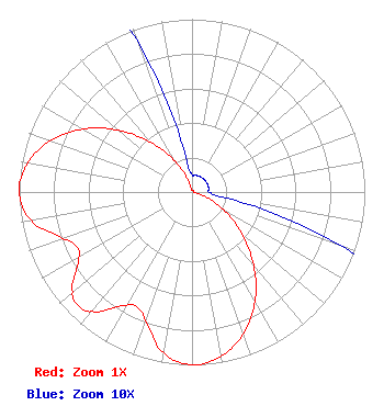 | ||||||||||||||||||
| Azimuth | Ratio | Azimuth | Ratio | Azimuth | Ratio | Azimuth | Ratio | ||||||||||||
| 0 | 0.010 | 10 | 0.010 | 20 | 0.010 | 30 | 0.010 | ||||||||||||
| 40 | 0.010 | 50 | 0.010 | 60 | 0.010 | 70 | 0.010 | ||||||||||||
| 80 | 0.010 | 90 | 0.010 | 100 | 0.021 | 110 | 0.094 | ||||||||||||
| 120 | 0.218 | 130 | 0.378 | 140 | 0.556 | 150 | 0.729 | ||||||||||||
| 160 | 0.872 | 170 | 0.967 | 180 | 1.000 | 190 | 0.947 | ||||||||||||
| 200 | 0.793 | 205 | 0.740 | 210 | 0.756 | 220 | 0.902 | ||||||||||||
| 225 | 0.933 | 230 | 0.902 | 240 | 0.756 | 245 | 0.740 | ||||||||||||
| 250 | 0.793 | 260 | 0.947 | 270 | 1.000 | 280 | 0.967 | ||||||||||||
| 290 | 0.872 | 300 | 0.729 | 310 | 0.556 | 320 | 0.378 | ||||||||||||
| 330 | 0.218 | 340 | 0.094 | 350 | 0.021 | ||||||||||||||
Structure Registration Number 1249321 Structure Type: Registered To: RADIANT LIFE MINISTRIES. INC. Structure Address: 3145 Bartlett Corp Drive Bartlett, TN County Name: Shelby County ASR Issued: 06/10/2021 Date Built: 04/01/2008 Site Elevation: 84.4 m (277 ft.) Structure Height: 274.3 m (900 ft.) Height Overall: 275.8 m (905 ft.) Overall Height AMSL: 360.2 m (1182 ft.) FAA Determination: 04/19/2005 FAA Study #: 2005-ASO-139-OE FAA Circular #: 70/7460-1K Paint & Light FAA Chapters: 3, 4, 5, 12 Removed expiration and final dates from determination. Scenario 2./jjs/case#635066 35-12-34.3 N 89-49-01.4 W (NAD 83) 35-12-34.0 N 89-49-01.1 W (Converted to NAD 27) |
Memphis, TN 38115 Phone: 901-375-9324 Individual | Title: Sole Proprietor Date: 03/30/2022 Application Certifier 6080 Mt. Moriah Ext. Memphis, TN 38115 Applicant William Jeffrey Reynolds Du Treil, Lundin & Rackley, Inc. 5120 Station Way Sarasota, FL 34233 Technical Consultant Stephen C Simpson Attorney At Law 1250 Connecticut Avenue, Nw Suite 700 Washington, DC 20036 | |||||||||||||||||