
FCCInfo.com
A Service of Cavell, Mertz & Associates, Inc.
(855) FCC-INFO
|
|
|
|
|
||||||||||||||||
|
|
Status: License Application Accepted: 03/27/2019 License Expires: 12/01/2022 File Number: -0000068720 FCC Website Links: LMS Facility Details This Application Other K18ND-D Applications Including Superseded Applications Mailing Address Correspondence for K18ND-D Correspondence related to application -0000068720 Service Contour - Open Street Map or USGS Map (51 dBu) Service Contour - KML / Google Earth (51 dBu) Rabbit Ears Info Search for K18ND-D Site Location: 39-57-28.6 N 121-42-52.9 W (NAD 83) Site Location: 39-57-29.0 N 121-42-49.0 W (Converted to NAD 27) ERP: 7 kW Polarization: Horizontally polarized R/C AGL: 101 m (331 ft.) R/C AMSL: 1166.3 m (3826 ft.) Emission Mask: Stringent Site Elevation: 1065.3 m. (3495 ft.) Height Overall*: 152.4 m (500 ft.) (* As Filed In This Application, may differ from ASR Data, Below.) Directional Antenna - Antenna Make/Model: Scala K723147 Special Antenna ID: 1004773 Polarization: Horizontally polarized
| ||||||||||||||||||
| Antenna Data for Antenna Id: 1004773 K18ND-D LD File: -0000068720 Scala - K723147 Special Service: LD Standard Pattern: N | 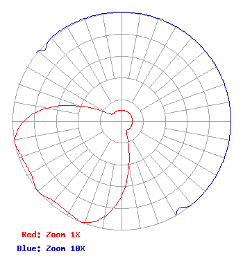 | ||||||||||||||||||
| Azimuth | Ratio | Azimuth | Ratio | Azimuth | Ratio | Azimuth | Ratio | ||||||||||||
| 0 | 0.100 | 10 | 0.100 | 20 | 0.100 | 30 | 0.100 | ||||||||||||
| 40 | 0.100 | 50 | 0.100 | 60 | 0.100 | 70 | 0.100 | ||||||||||||
| 80 | 0.100 | 90 | 0.100 | 100 | 0.100 | 110 | 0.100 | ||||||||||||
| 120 | 0.100 | 130 | 0.100 | 140 | 0.100 | 150 | 0.100 | ||||||||||||
| 160 | 0.150 | 170 | 0.400 | 180 | 0.690 | 190 | 0.890 | ||||||||||||
| 200 | 0.990 | 210 | 0.970 | 220 | 0.960 | 230 | 1.000 | ||||||||||||
| 240 | 0.960 | 250 | 0.970 | 260 | 0.990 | 270 | 0.890 | ||||||||||||
| 280 | 0.690 | 290 | 0.400 | 300 | 0.150 | 310 | 0.100 | ||||||||||||
| 320 | 0.100 | 330 | 0.100 | 340 | 0.100 | 350 | 0.100 | ||||||||||||
Structure Registration Number 1258123 Structure Type: TOWER Registered To: California TV, LLC Structure Address: 10895 Cohasset Rd. Cohasset, CA County Name: Butte County ASR Issued: 12/02/2015 Date Built: 06/18/2008 Site Elevation: 1065.3 m (3495 ft.) Structure Height: 151.5 m (497 ft.) Height Overall: 152.4 m (500 ft.) Overall Height AMSL: 1217.7 m (3995 ft.) FAA Determination: 04/23/2007 FAA Study #: 2007-AWP-318-OE FAA Circular #: 70/7460-1K Paint & Light FAA Chapters: 3, 4, 5, 12 Removed expiration date from determination. Scenario 1./jjs/case#635066 39-57-28.6 N 121-42-52.9 W (NAD 83) 39-57-29.0 N 121-42-49.0 W (Converted to NAD 27) |
603 North Market Street Redding, CA 96003 Phone: 530-243-5493 Not-for-Profit | Title: General Manager And Ceo Date: 03/27/2019 Application Certifier Northern California Educational Television Association, Inc. 603 North Market Street Redding, CA 96003 Applicant Melodie A. Virtue Garvey Schubert Barer, P.c. 1000 Potomac Street, N.w. Suite 200 Washington, DC 20007 FCC Counsel Kevin Fisher Smith And Fisher, Llc Smith And Fisher, Llc 4791 Wintergreen Court Woodbridge, VA 22192 ENGINEERING CONSULTANT Steven C. Schaffer, Esq Garvey Schubert Barer, P.c. 1000 Potomac Street, N.w. Suite 200 Washington, DC 20007 | |||||||||||||||||