
FCCInfo.com
A Service of Cavell, Mertz & Associates, Inc.
(855) FCC-INFO
|
|
W33EM-D from 03/20/1997 W33EM-D from 07/23/1985 |
|
|
||||||||||||||||
|
|
Status: License Application Accepted: 10/20/2021 License Expires: 08/01/2023 File Number: -0000164350 FCC Website Links: LMS Facility Details This Application Other W33EM-D Applications Including Superseded Applications Mailing Address Correspondence for W33EM-D Correspondence related to application -0000164350 Service Contour - Open Street Map or USGS Map (51 dBu) Service Contour - KML / Google Earth (51 dBu) Rabbit Ears Info Search for W33EM-D Site Location: 40-00-46.7 N 78-53-20.7 W (NAD 83) Site Location: 40-00-46.4 N 78-53-21.6 W (Converted to NAD 27) ERP: 2 kW Polarization: Horizontally polarized R/C AGL: 30 m (98 ft.) R/C AMSL: 756.6 m (2482 ft.) Emission Mask: Full Service Site Elevation: 726.6 m. (2384 ft.) Height Overall*: 78.9 m (259 ft.) (* As Filed In This Application, may differ from ASR Data, Below.) Directional Antenna - Antenna Make/Model: PR-TV x2 1@120 1@290 SCA Antenna ID: 1008844 Polarization: Horizontally polarized
| ||||||||||||||||||
| Antenna Data for Antenna Id: 1008844 W33EM-D LD File: -0000164350 PR-TV x2 1@120 1@290 - SCA Service: LD Standard Pattern: N | 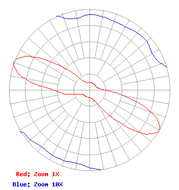 | ||||||||||||||||||
| Azimuth | Ratio | Azimuth | Ratio | Azimuth | Ratio | Azimuth | Ratio | ||||||||||||
| 0 | 0.093 | 10 | 0.092 | 20 | 0.090 | 30 | 0.090 | ||||||||||||
| 40 | 0.092 | 50 | 0.093 | 60 | 0.090 | 70 | 0.095 | ||||||||||||
| 80 | 0.117 | 90 | 0.188 | 100 | 0.445 | 110 | 0.811 | ||||||||||||
| 115 | 0.943 | 120 | 1.000 | 125 | 0.945 | 130 | 0.814 | ||||||||||||
| 140 | 0.448 | 150 | 0.198 | 160 | 0.127 | 170 | 0.103 | ||||||||||||
| 180 | 0.096 | 190 | 0.092 | 200 | 0.093 | 210 | 0.093 | ||||||||||||
| 220 | 0.092 | 230 | 0.096 | 240 | 0.103 | 250 | 0.155 | ||||||||||||
| 260 | 0.297 | 270 | 0.448 | 280 | 0.814 | 285 | 0.945 | ||||||||||||
| 290 | 1.000 | 295 | 0.943 | 300 | 0.811 | 310 | 0.445 | ||||||||||||
| 320 | 0.188 | 330 | 0.117 | 340 | 0.095 | 350 | 0.090 | ||||||||||||
Structure Registration Number 1287762 Structure Type: LTOWER Registered To: Cellco Partnership Structure Address: 1541 Cornerstone Road Friedens, PA County Name: Somerset County ASR Issued: 06/14/2017 Date Built: 11/20/2013 Site Elevation: 726.6 m (2384 ft.) Structure Height: 76.2 m (250 ft.) Height Overall: 78.9 m (259 ft.) Overall Height AMSL: 805.5 m (2643 ft.) FAA Determination: 12/10/2012 FAA Study #: 2012-AEA-5432-OE FAA Circular #: 70/7460-1K Paint & Light FAA Chapters: 4, 8, 12 Removed expiration date from determination. Scenario 1./jjs/case#635066 40-00-46.7 N 78-53-20.7 W (NAD 83) 40-00-46.4 N 78-53-21.6 W (Converted to NAD 27) |
Chattanooga, TN 37401 Phone: 423-468-5100 Limited Liability Company | Title: Coo Date: 10/20/2021 Application Certifier DIGITAL NETWORKS-NORTHEAST, LLC Digital Networks-northeast, Llc Chattanooga, TN 37401 Applicant Jeremy D Ruck, PE Jeremy Ruck & Associates, Inc. Canton, IL 61520 Consulting Engineer Aaron P Shainis Shainis & Peltzman, Chartered 1850 M St. Nw Suite 240 Washington, DC 20036 FCC Legal Counsel | |||||||||||||||||