
FCCInfo.com
A Service of Cavell, Mertz & Associates, Inc.
(855) FCC-INFO
|
|
K20KF-D from 12/04/1998 |
|
|
||||||||||||||||
|
|
Status: Construction Permit (Licensed And Silent) Application Accepted: 08/25/2022 K20KF-D CP Expires: 08/01/2024 File Number: -0000198325 FCC Website Links: LMS Facility Details This Application Other K20KF-D Applications Including Superseded Applications Mailing Address Correspondence for K20KF-D Correspondence related to application -0000198325 Service Contour - Open Street Map or USGS Map (51 dBu) Service Contour - KML / Google Earth (51 dBu) Rabbit Ears Info Search for K20KF-D Site Location: 41-33-08.4 N 90-37-06.2 W (NAD 83) Site Location: 41-33-08.3 N 90-37-05.7 W (Converted to NAD 27) ERP: 15 kW Polarization: Elliptically polarized R/C AGL: 48.8 m (160 ft.) R/C AMSL: 248.7 m (816 ft.) Emission Mask: Full Service Site Elevation: 199.9 m. (656 ft.) Height Overall*: 81.4 m (267 ft.) (* As Filed In This Application, may differ from ASR Data, Below.) Directional Antenna - Antenna Make/Model: Kathrein 4X2 UTVC-01/X Antenna ID: 1009960 Polarization: Elliptically polarized | ||||||||||||||||||
| Antenna Data for Antenna Id: 1009960 K20KF-D LD File: -0000198325 Kathrein - 4X2 UTVC-01/X Service: LD Standard Pattern: Y | 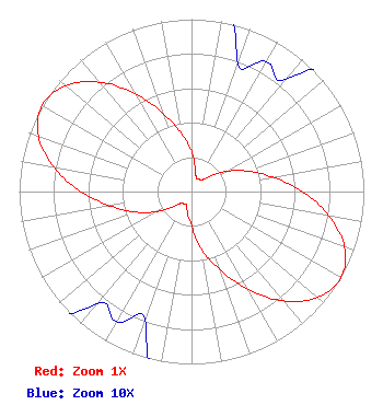 | ||||||||||||||||||
| Azimuth | Ratio | Azimuth | Ratio | Azimuth | Ratio | Azimuth | Ratio | ||||||||||||
| 0 | 0.231 | 10 | 0.130 | 20 | 0.079 | 30 | 0.087 | ||||||||||||
| 40 | 0.085 | 50 | 0.134 | 60 | 0.234 | 70 | 0.347 | ||||||||||||
| 80 | 0.480 | 90 | 0.642 | 100 | 0.810 | 110 | 0.945 | ||||||||||||
| 120 | 1.000 | 130 | 0.955 | 140 | 0.828 | 150 | 0.654 | ||||||||||||
| 160 | 0.484 | 170 | 0.343 | 180 | 0.198 | 190 | 0.130 | ||||||||||||
| 200 | 0.079 | 210 | 0.087 | 220 | 0.085 | 230 | 0.134 | ||||||||||||
| 240 | 0.234 | 250 | 0.347 | 260 | 0.480 | 270 | 0.642 | ||||||||||||
| 280 | 0.810 | 290 | 0.945 | 300 | 1.000 | 310 | 0.955 | ||||||||||||
| 320 | 0.828 | 330 | 0.654 | 340 | 0.484 | 350 | 0.343 | ||||||||||||
Structure Registration Number 1056220 Structure Type: TOWER Registered To: American Towers, LLC Structure Address: 3111 Hickory Grove Road (sundholm #303534) Davenport, IA County Name: Scott County ASR Issued: 02/07/2020 Date Built: 09/23/1998 Site Elevation: 199.9 m (656 ft.) Structure Height: 75.3 m (247 ft.) Height Overall: 81.4 m (267 ft.) Overall Height AMSL: 281.3 m (923 ft.) FAA Determination: 06/23/2010 FAA Study #: 2010-ACE-1613-OE FAA Circular #: 70/7460-1K Paint & Light FAA Chapters: 4, 8, 12 OM&L to remain the same as prior study = A MED-DUAL SYSTEM 41-33-08.4 N 90-37-06.2 W (NAD 83) 41-33-08.3 N 90-37-05.7 W (Converted to NAD 27) |
Hurst, TX 76054 Phone: 214-770-7770 Corporation | Title: Ceo Date: 08/25/2022 Application Certifier EDGE SPECTRUM, INC. Edge Spectrum, Inc. Hurst, TX 76054 Applicant Susan Hansen B. W. St. Clair 2305 Vida Shaw Rd. New Iberia, LA 70563 Consultant Ari Meltzer Wiley Rein Llp 2050 M Street, Nw Washington, DC 20036 Josh Weiss Ark Multicasting, Inc. Cedar Hill, TX 75106 CEO Caleb Weiss Ark Multicasting, Inc. Cedar Hill, TX 75106 President Randy Weiss Edge Spectrum, Inc. Hurst, TX 76054 CEO | |||||||||||||||||