
FCCInfo.com
A Service of Cavell, Mertz & Associates, Inc.
(855) FCC-INFO
|
|
|
|
|
||||||||||||||||
|
|
Status: License Application Accepted: 02/27/2012 License Expires: 10/01/2022 File Number: BLDTT-20120227ABI Prefix Type: This is BLDTT FCC Website Links: LMS Facility Details This Application Other K36JS-D Applications Including Superseded Applications Mailing Address Correspondence for K36JS-D Correspondence related to application BLDTT-20120227ABI Service Contour - Open Street Map or USGS Map (51 dBu) Service Contour - KML / Google Earth (51 dBu) Rabbit Ears Info Search for K36JS-D Site Location: 35-07-09.1 N 107-54-04.2 W (NAD 83) Site Location: 35-07-09.0 N 107-54-02.0 W (Converted to NAD 27) ERP: 0.1 kW R/C AGL: 14 m (46 ft.) R/C AMSL: 2172 m (7126 ft.) Emission Mask: Stringent Site Elevation: 2158 m. (7080 ft.) Height Overall*: 23 m (75 ft.) (* As Filed In This Application, may differ from ASR Data, Below.) Directional Antenna - Antenna Make/Model: Scala 4DR-4-2HW Antenna ID: 20741
| ||||||||||||||||||
| Antenna Data for Antenna Id: 20741 K36JS-D LD File: BLDTT-20120227ABI Scala - 4DR-4-2HW Service: LD Standard Pattern: Y Pattern and Field Values Include a 30° Clockwise Rotation | 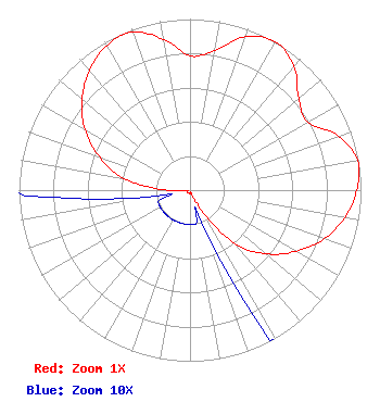 | ||||||||||||||||||
| Azimuth | Ratio | Azimuth | Ratio | Azimuth | Ratio | Azimuth | Ratio | ||||||||||||
| 0 | 0.784 | 10 | 0.827 | 20 | 0.955 | 30 | 1.000 | ||||||||||||
| 40 | 0.945 | 50 | 0.830 | 60 | 0.795 | 70 | 0.925 | ||||||||||||
| 80 | 0.995 | 90 | 0.975 | 100 | 0.920 | 110 | 0.835 | ||||||||||||
| 120 | 0.715 | 130 | 0.580 | 140 | 0.410 | 150 | 0.135 | ||||||||||||
| 160 | 0.020 | 170 | 0.020 | 180 | 0.020 | 190 | 0.020 | ||||||||||||
| 200 | 0.020 | 210 | 0.020 | 220 | 0.020 | 230 | 0.020 | ||||||||||||
| 240 | 0.020 | 250 | 0.020 | 260 | 0.020 | 270 | 0.130 | ||||||||||||
| 280 | 0.395 | 290 | 0.560 | 300 | 0.710 | 310 | 0.825 | ||||||||||||
| 320 | 0.915 | 330 | 0.975 | 340 | 0.983 | 350 | 0.895 | ||||||||||||
Structure Registration Number 1216858 Structure Type: TOWER Registered To: Regents of the University of New Mexico & the Board of Education of Albuquerque, N.M. Structure Address: 4.63 Km Due South Of Grants Municipal Airport Atop Of Cerrito Colorado Grants, NM County Name: Cibola County ASR Issued: 09/01/2000 Date Built: 09/15/2000 Site Elevation: 2158 m (7080 ft.) Structure Height: 18.3 m (60 ft.) Height Overall: 22.9 m (75 ft.) Overall Height AMSL: 2180.9 m (7155 ft.) FAA Determination: 08/17/2000 FAA Study #: 00-ASW-4068-OE Paint & Light FAA Chapters: NONE Removed expiration date from determination. Scenario 1./jjs/case#635066 35-07-09.1 N 107-54-04.2 W (NAD 83) 35-07-09.0 N 107-54-02.0 W (Converted to NAD 27) |
3415 University Ave., West St. Paul, MN 55114 Phone: 651-642-4334 Limited Liability Company | Date: 02/27/2012 Application Certifier KOB-TV, LLC 3415 University Avenue, West St. Paul, MN 55114-2099 Applicant WAYNE KOONTZ 4 Broadcast Plaza, S.w. Albuquerque, NM 87104 RF SYSTEMS SUPERVISOR FRANK R. JAZZO, ESQUIRE Fletcher, Heald & Hildreth, Pl.c. | |||||||||||||||||