
FCCInfo.com
A Service of Cavell, Mertz & Associates, Inc.
(855) FCC-INFO
|
|
|
Virtual Channel 13 |  |
|
|||||||||||||||||||||||||||
|
|
Repacking Information: No changes Status: License Application Accepted: 10/17/2023 License Expires: 10/01/2022 File Number: BLEDT-20120808ABN Prefix Type: This is a license for a noncommercial educational digital TV station FCC Website Links: LMS Facility Details This Application Other KIPT Applications Including Superseded Applications Mailing Address Correspondence for KIPT Correspondence related to application BLEDT-20120808ABN Service Contour - Open Street Map or USGS Map (41 dBu) Service Contour - KML / Google Earth (41 dBu) Public Inspection Files Rabbit Ears Info Search for KIPT DTS Site Number: 2 Site Location: 43-16-50.0 N 114-09-17.0 W (NAD 83) Site Location: 43-16-50.3 N 114-09-13.9 W (Converted to NAD 27) ERP: 0.04 kW Polarization: Horizontally polarized HAAT: 487 m (1598 ft.) R/C AGL: 12.2 m (40 ft.) R/C AMSL: 2015.2 m (6612 ft.) Site Elevation: 2003 m. (6572 ft.) Height Overall*: 39.6 m (130 ft.) (* As Filed In This Application, may differ from ASR Data, Below.) Directional Antenna - Antenna Make/Model: Scala 4DR-8S Antenna ID: 20753 Polarization: Horizontally polarized
| ||||||||||||||||||||||||||||||
| Antenna Data for Antenna Id: 20753 KIPT DD File: BLEDT-20120808ABN Scala - 4DR-8S Service: DD Standard Pattern: Y | 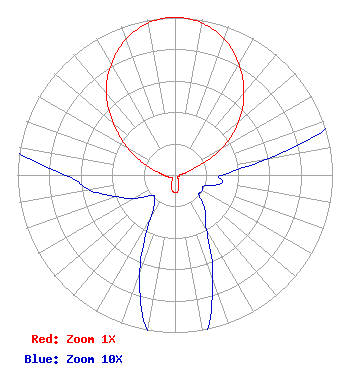 | ||||||||||||||||||||||||||||||
| Azimuth | Ratio | Azimuth | Ratio | Azimuth | Ratio | Azimuth | Ratio | ||||||||||||||||||||||||
| 0 | 1.000 | 10 | 0.980 | 20 | 0.917 | 30 | 0.813 | ||||||||||||||||||||||||
| 40 | 0.680 | 50 | 0.530 | 60 | 0.350 | 70 | 0.140 | ||||||||||||||||||||||||
| 80 | 0.060 | 90 | 0.030 | 100 | 0.030 | 110 | 0.020 | ||||||||||||||||||||||||
| 120 | 0.020 | 130 | 0.020 | 140 | 0.030 | 150 | 0.040 | ||||||||||||||||||||||||
| 160 | 0.070 | 170 | 0.105 | 180 | 0.110 | 190 | 0.100 | ||||||||||||||||||||||||
| 200 | 0.065 | 210 | 0.030 | 220 | 0.020 | 230 | 0.020 | ||||||||||||||||||||||||
| 240 | 0.030 | 250 | 0.040 | 260 | 0.055 | 270 | 0.070 | ||||||||||||||||||||||||
| 280 | 0.115 | 290 | 0.210 | 300 | 0.350 | 310 | 0.510 | ||||||||||||||||||||||||
| 320 | 0.680 | 330 | 0.810 | 340 | 0.915 | 350 | 0.980 | ||||||||||||||||||||||||
Structure Registration Number 1234527 Structure Type: LTOWER Registered To: American Towers LLC Structure Address: Picabo Mt. (207818) Gannett, ID County Name: Blaine County ASR Issued: 12/29/2022 Date Built: 01/02/2003 Site Elevation: 2003.5 m (6573 ft.) Structure Height: 39.6 m (130 ft.) Height Overall: 39.6 m (130 ft.) Overall Height AMSL: 2043.1 m (6703 ft.) FAA Determination: 12/15/2022 FAA Study #: 2022-ANM-3312-OE Paint & Light FAA Chapters: NONE PRIOR STUDY 2002-ANM-785-OE 43-16-50.0 N 114-09-17.0 W (NAD 83) 43-16-50.3 N 114-09-13.9 W (Converted to NAD 27) |
1455 North Orchard Street Attn: Craig Koster Boise, ID 83706 Phone: 208-373-7220 Fax: 208-373-7245 Government Entity | Date: 08/08/2012 Application Certifier STATE BOARD OF EDUCATION, STATE OF IDAHO 1455 N. Orchard Street Attn: Richard Van Genderen Boise, ID 83706-2239 Applicant RICHARD VAN GENDEREN Idaho Public Television 1455 N. Orchard Street Boise, ID 83706-2239 TECHNOLOGY DIRECTOR ANNE GOODWIN CRUMP Fletcher, Heald And Hildreth, P.l.c. | |||||||||||||||||||||||||||||
| |||||||||||||||||||||||||||||||